

Services
Services

High-accuracy RTK mapping, ground control integration, and survey-ready aerial datasets for engineering, construction, and land development projects.

Recurring site documentation and progress tracking for earthwork, infrastructure installation, and project milestones.

RGB and multispectral data collection for crop monitoring, irrigation analysis, vegetation assessment, and research plots.
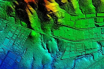
Dense point cloud acquisition for terrain modeling, vegetation penetration, corridor mapping, and engineering applications.

Thermal imaging for solar inspections, roof assessments, electrical systems, utility infrastructure, and heat-loss investigations.

Asset documentation, corridor mapping, utility inspections, and infrastructure monitoring across large project areas.

Local aerial data collection and field support for companies that need California coverage without sending their own team.
